 vesseltracker.com
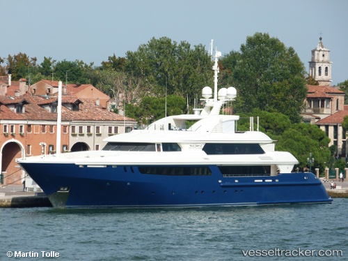
Mary Jean Ii
Current StatusWhere is the vessel?
Mary Jean Ii is currently in Near LA CIOTAT, based on AIS data received about 2h ago.
Latest AIS update:
Current position: 43.17124° N, 5.61119° E (Near LA CIOTAT)
Average speed (last 7 days): Loading…
Average speed (last 30 days): Loading…
Vessel profile: Mary Jean Ii is a Service Ship with dimensions 12m x 60m.
This page combines live AIS, route history, probable destination signals, nearby traffic, and port activity for practical vessel monitoring.
The current position of vessel Mary Jean Ii is 43.17124 lat / 5.61119 lng. Updated: 2026-05-15 01:15:40 UTCNearest reference points:
- Near LA CIOTAT
- Near Six-Fours-les-Plages
- Near Le Canet
Details:
Live Vessel Mary Jean Ii Analytics (details, animations, etc.)
Recent AIS points (UTC):
2026-05-14 22:00:40 UTC · 43.17124, 5.61119 · SOG 0 kn · COG 39°2026-05-14 22:33:40 UTC · 43.17123, 5.61119 · SOG 0 kn · COG 39°
2026-05-14 23:57:40 UTC · 43.17124, 5.61119 · SOG 0 kn · COG 39°
2026-05-15 01:15:40 UTC · 43.17124, 5.61119 · SOG 0 kn · COG 39°