 vesseltracker.com
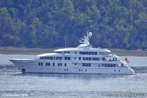
 Invictus
Current Status
Where is the vessel?
Invictus is currently in Near Lyford Cay, based on AIS data received less than 1h ago.
Latest AIS update:
Current position: 25.03618° N, 77.51320° W (Near Lyford Cay)
Average speed (last 7 days): Loading…
Average speed (last 30 days): Loading…
Vessel profile: Invictus is a Service Ship with dimensions 65m x 13m.
This page combines live AIS, route history, probable destination signals, nearby traffic, and port activity for practical vessel monitoring.
The current position of vessel Invictus is 25.03618 lat / -77.51320 lng. Updated: 2026-04-30 19:40:18 UTCNearest reference points:
- Near Lyford Cay
- Near Nassau
- 11 nm S of Lyford Cay
Currently sailing under the flag of Cayman Is ![]()
Invictus built in 2013 year
Deadweight:
432 tDetails:
Live Vessel Invictus Analytics (details, animations, etc.)
Recent AIS points (UTC):
2026-04-30 16:22:21 UTC · 25.03617, -77.51319 · SOG 0 kn · COG 80°2026-04-30 18:01:17 UTC · 25.03616, -77.51322 · SOG 0 kn · COG 79°
2026-04-30 19:37:23 UTC · 25.03619, -77.51320 · SOG 0 kn · COG 80°
2026-04-30 19:40:18 UTC · 25.03618, -77.51320 · SOG 0 kn · COG 80°