 vesseltracker.com
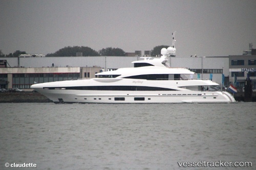
Mysky
Current StatusWhere is the vessel?
Mysky is currently in 22 nm NW of Tusdeer Free Zone, based on AIS data received less than 1h ago.
Latest AIS update:
Current position: 21.79777° N, 38.93611° E (22 nm NW of Tusdeer Free Zone)
Average speed (last 7 days): Loading…
Average speed (last 30 days): Loading…
Vessel profile: Mysky is a Service Ship with dimensions 9m x 51m.
This page combines live AIS, route history, probable destination signals, nearby traffic, and port activity for practical vessel monitoring.
The current position of vessel Mysky is 21.79777 lat / 38.93611 lng. Updated: 2026-05-14 05:04:54 UTCNearest reference points:
- 23 nm NW of Tusdeer Free Zone
- 22 nm N of Tusdeer Free Zone
- 14 nm N of Tusdeer Free Zone
Details:
Live Vessel Mysky Analytics (details, animations, etc.)
Recent AIS points (UTC):
2026-05-14 01:32:25 UTC · 21.79767, 38.93630 · SOG 0 kn · COG 328°2026-05-14 02:06:48 UTC · 21.79750, 38.93637 · SOG 0.2 kn · COG 327°
2026-05-14 03:52:44 UTC · 21.79753, 38.93637 · SOG 0 kn · COG 328°
2026-05-14 05:04:54 UTC · 21.79777, 38.93611 · SOG 0 kn · COG 328°