 vesseltracker.com
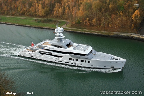
Elysian
Current StatusWhere is the vessel?
Elysian is currently in Near PALMA DE MALLORCA, based on AIS data received less than 1h ago.
Latest AIS update:
Current position: 39.56342° N, 2.63691° E (Near PALMA DE MALLORCA)
Average speed (last 7 days): Loading…
Average speed (last 30 days): Loading…
Vessel profile: Elysian is a Service Ship with dimensions 13m x 66m.
This page combines live AIS, route history, probable destination signals, nearby traffic, and port activity for practical vessel monitoring.
The current position of vessel Elysian is 39.56342 lat / 2.63691 lng. Updated: 2026-05-16 07:29:33 UTCNearest reference points:
- Near PALMA DE MALLORCA
- Near Palma
- Near PORTALS NOUS
Details:
Live Vessel Elysian Analytics (details, animations, etc.)
Recent AIS points (UTC):
2026-05-16 03:21:00 UTC · 39.56339, 2.63695 · SOG 0 kn · COG 324°2026-05-16 04:03:01 UTC · 39.56338, 2.63696 · SOG 0 kn · COG 325°
2026-05-16 05:32:29 UTC · 39.56338, 2.63698 · SOG 0 kn · COG 325°
2026-05-16 07:29:33 UTC · 39.56342, 2.63691 · SOG 0 kn · COG 325°