 vesseltracker.com
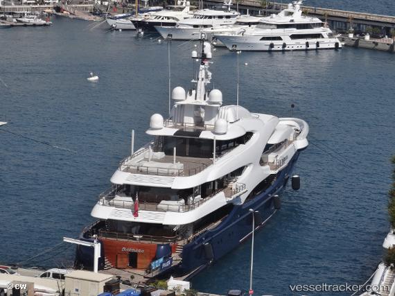
 Barbara
Current Status
Where is the vessel?
Barbara is currently in Near LA CIOTAT, based on AIS data received less than 1h ago.
Latest AIS update:
Current position: 43.17015° N, 5.60708° E (Near LA CIOTAT)
Average speed (last 7 days): Loading…
Average speed (last 30 days): Loading…
Vessel profile: Barbara is a Sailing Vessel with dimensions 89m x 14m.
This page combines live AIS, route history, probable destination signals, nearby traffic, and port activity for practical vessel monitoring.
The current position of vessel Barbara is 43.17015 lat / 5.60708 lng. Updated: 2026-05-13 21:52:37 UTCNearest reference points:
- Near LA CIOTAT
- Near Six-Fours-les-Plages
- Near Le Canet
Currently sailing under the flag of Cayman Is ![]()
Details:
Live Vessel Barbara Analytics (details, animations, etc.)
Recent AIS points (UTC):
2026-05-13 17:28:37 UTC · 43.17016, 5.60705 · SOG 0 kn · COG -1°2026-05-13 19:49:35 UTC · 43.17018, 5.60707 · SOG 0.1 kn · COG -1°
2026-05-13 19:55:36 UTC · 43.17017, 5.60706 · SOG 0.2 kn · COG -1°
2026-05-13 21:52:37 UTC · 43.17015, 5.60708 · SOG 0.1 kn · COG -1°