 vesseltracker.com
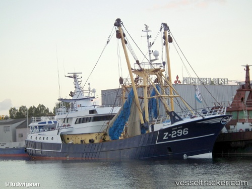
Z 296
Current StatusWhere is the vessel?
Z 296 is currently in 20 nm NW of Guernsey, based on AIS data received less than 1h ago.
Latest AIS update:
Current position: 49.62465° N, 2.99234° W (20 nm NW of Guernsey)
Average speed (last 7 days): Loading…
Average speed (last 30 days): Loading…
Vessel profile: Z 296 is a Fishing Vessel with dimensions 9m x 38m.
This page combines live AIS, route history, probable destination signals, nearby traffic, and port activity for practical vessel monitoring.
The current position of vessel Z 296 is 49.62465 lat / -2.99234 lng. Updated: 2026-04-28 22:29:39 UTCNearest reference points:
- 23 nm NW of Saint Sampson
- Near Saint Sampson
- Near GUERNSEY
Details:
Live Vessel Z 296 Analytics (details, animations, etc.)
Recent AIS points (UTC):
2026-04-28 18:07:20 UTC · 49.71121, -2.93721 · SOG 4.7 kn · COG 5°2026-04-28 19:54:20 UTC · 49.75256, -2.89371 · SOG 0.4 kn · COG 288°
2026-04-28 21:34:31 UTC · 49.68955, -2.94187 · SOG 4.7 kn · COG 150°
2026-04-28 22:29:39 UTC · 49.62465, -2.99234 · SOG 5.3 kn · COG 235°