 vesseltracker.com
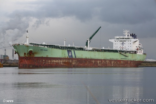
 PELAGIC TOPE
Current Status
Where is the vessel?
PELAGIC TOPE is currently in 103 nm N of Noord, based on AIS data received about 1h ago.
Latest AIS update:
Current position: 14.25388° N, 69.69213° W (103 nm N of Noord)
Average speed (last 7 days): Loading…
Average speed (last 30 days): Loading…
Vessel profile: PELAGIC TOPE is a Oil Products Tanker with dimensions 228m x 32m.
This page combines live AIS, route history, probable destination signals, nearby traffic, and port activity for practical vessel monitoring.
The current position of vessel PELAGIC TOPE is 14.25388 lat / -69.69213 lng. Updated: 2026-05-15 05:30:09 UTCNearest reference points:
- 148 nm N of Dorp Rincón
- 24 nm NW of Palm Beach
- Near Bullenbaai
Currently sailing under the flag of Cyprus ![]()
PELAGIC TOPE built in 2008 year
Deadweight:
76578 tDetails:
Live Vessel PELAGIC TOPE Analytics (details, animations, etc.)
Recent AIS points (UTC):
2026-05-15 01:25:57 UTC · 14.35232, -69.57243 · SOG 2.3 kn · COG 181°2026-05-15 04:11:33 UTC · 14.28572, -69.65300 · SOG 2.3 kn · COG 184°
2026-05-15 04:21:58 UTC · 14.28152, -69.65837 · SOG 2.3 kn · COG 185°
2026-05-15 05:30:09 UTC · 14.25388, -69.69213 · SOG 2.4 kn · COG 183°