 vesseltracker.com
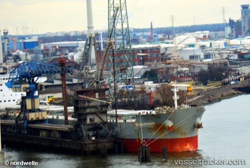
 Panagia Stenion
Current Status
Where is the vessel?
Panagia Stenion is currently in 63 nm E of PANGKAL BALAM, based on AIS data received about 1d ago.
Latest AIS update:
Current position: 1.75474° S, 107.12088° E (63 nm E of PANGKAL BALAM)
Average speed (last 7 days): Loading…
Average speed (last 30 days): Loading…
Vessel profile: Panagia Stenion is a Bulk Carrier with dimensions 225m x 32m.
This page combines live AIS, route history, probable destination signals, nearby traffic, and port activity for practical vessel monitoring.
The current position of vessel Panagia Stenion is -1.75474 lat / 107.12088 lng. Updated: 2026-04-23 11:29:38 UTCNearest reference points:
- 46 nm NW of Tanjung Pandan
- Near PANGKAL BALAM
- 53 nm NE of Tanjung Pandan
Currently sailing under the flag of Cyprus ![]()
Panagia Stenion built in 2012 year
Deadweight:
76072 tDetails:
Live Vessel Panagia Stenion Analytics (details, animations, etc.)
Recent AIS points (UTC):
2026-04-23 11:29:38 UTC · -1.75474, 107.12088 · SOG 10.6 kn · COG 344°2026-04-23 11:29:38 UTC · -1.75474, 107.12088 · SOG 10.6 kn · COG 344°
2026-04-23 11:29:38 UTC · -1.75474, 107.12088 · SOG 10.6 kn · COG 344°
2026-04-23 11:29:38 UTC · -1.75474, 107.12088 · SOG 10.6 kn · COG 344°