 vesseltracker.com
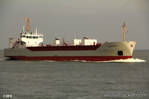
 Cemstar
Current Status
Where is the vessel?
Cemstar is currently in 13 nm S of Zut Marina, based on AIS data received less than 1h ago.
Latest AIS update:
Current position: 43.67850° N, 15.22579° E (13 nm S of Zut Marina)
Average speed (last 7 days): Loading…
Average speed (last 30 days): Loading…
Vessel profile: Cemstar is a Cement Carrier with dimensions 88m x 13m.
This page combines live AIS, route history, probable destination signals, nearby traffic, and port activity for practical vessel monitoring.
The current position of vessel Cemstar is 43.67850 lat / 15.22579 lng. Updated: 2026-04-21 19:53:22 UTCNearest reference points:
- Near Pasman
- Near VRGADA
- Near GAZENICA
Currently sailing under the flag of Cyprus ![]()
Cemstar built in 1989 year
Deadweight:
3180 tDetails:
Live Vessel Cemstar Analytics (details, animations, etc.)
Recent AIS points (UTC):
2026-04-21 15:35:13 UTC · 43.44840, 15.97090 · SOG 9.1 kn · COG 260°2026-04-21 16:22:11 UTC · 43.42483, 15.81151 · SOG 9 kn · COG 262°
2026-04-21 18:00:02 UTC · 43.49787, 15.51447 · SOG 9 kn · COG 310°
2026-04-21 19:53:22 UTC · 43.67850, 15.22579 · SOG 8.8 kn · COG 315°