 vesseltracker.com
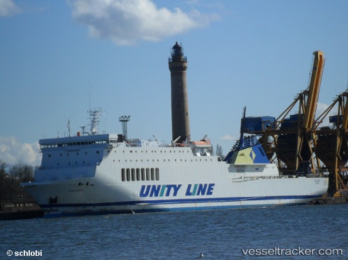
 Galileusz
Current Status
Where is the vessel?
Galileusz is currently in 13 nm E of Vierow, based on AIS data received less than 1h ago.
Latest AIS update:
Current position: 54.34966° N, 14.13767° E (13 nm E of Vierow)
Average speed (last 7 days): Loading…
Average speed (last 30 days): Loading…
Vessel profile: Galileusz is a Passenger Ro Ro Cargo Ship with dimensions m x m.
This page combines live AIS, route history, probable destination signals, nearby traffic, and port activity for practical vessel monitoring.
The current position of vessel Galileusz is 54.34966 lat / 14.13767 lng. Updated: 2026-05-15 22:11:59 UTCNearest reference points:
- Near Baabe (Ostseebad)
- Near PEENEMUNDE
- Near WOLGAST
Currently sailing under the flag of Cyprus ![]()
Galileusz built in 1992 year
Deadweight:
7330 tDetails:
Live Vessel Galileusz Analytics (details, animations, etc.)
Recent AIS points (UTC):
2026-05-15 19:08:47 UTC · 55.03583, 13.88033 · SOG 14.1 kn · COG 159°2026-05-15 19:54:48 UTC · 54.86450, 13.95116 · SOG 13.8 kn · COG 164°
2026-05-15 21:47:32 UTC · 54.44133, 14.10550 · SOG 13.9 kn · COG 166°
2026-05-15 22:11:59 UTC · 54.34966, 14.13767 · SOG 14 kn · COG 162°