 vesseltracker.com
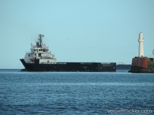
 ACE BRAEMAR
Current Status
Where is the vessel?
ACE BRAEMAR is currently in Near Aberdeen, based on AIS data received less than 1h ago.
Latest AIS update:
Current position: 57.14572° N, 2.09395° W (Near Aberdeen)
Average speed (last 7 days): Loading…
Average speed (last 30 days): Loading…
Vessel profile: ACE BRAEMAR is a Offshore Supply Ship with dimensions m x m.
This page combines live AIS, route history, probable destination signals, nearby traffic, and port activity for practical vessel monitoring.
The current position of vessel ACE BRAEMAR is 57.14572 lat / -2.09395 lng. Updated: 2026-04-26 13:11:10 UTCNearest reference points:
- Near Aberdeen
- Near PETERHEAD
- Near Peterhead
Details:
Live Vessel ACE BRAEMAR Analytics (details, animations, etc.)
Recent AIS points (UTC):
2026-04-26 10:11:07 UTC · 57.14574, -2.09400 · SOG 0 kn · COG 54°2026-04-26 10:15:07 UTC · 57.14575, -2.09387 · SOG 0 kn · COG 54°
2026-04-26 11:56:06 UTC · 57.14571, -2.09389 · SOG 0 kn · COG 54°
2026-04-26 13:11:10 UTC · 57.14572, -2.09395 · SOG 0 kn · COG 54°