 vesseltracker.com
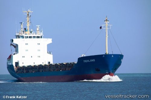
 MANUELA S
Current Status
Where is the vessel?
MANUELA S is currently in 42 nm E of Claonaig, based on AIS data received about 3h ago.
Latest AIS update:
Current position: 55.60857° N, 6.60362° E (42 nm E of Claonaig)
Average speed (last 7 days): Loading…
Average speed (last 30 days): Loading…
Vessel profile: MANUELA S is a General Cargo Ship with dimensions 105m x 16m.
This page combines live AIS, route history, probable destination signals, nearby traffic, and port activity for practical vessel monitoring.
The current position of vessel MANUELA S is 55.60857 lat / 6.60362 lng. Updated: 2026-04-25 18:11:44 UTCNearest reference points:
- 36 nm W of HVIDE SANDE
- Near Blavand
- Near Basel
Currently sailing under the flag of Cyprus ![]()
MANUELA S built in 1989 year
Deadweight:
4402 tDetails:
Live Vessel MANUELA S Analytics (details, animations, etc.)
Recent AIS points (UTC):
2026-04-25 15:25:54 UTC · 55.70738, 6.70787 · SOG 10.6 kn · COG 211°2026-04-25 15:25:54 UTC · 55.70738, 6.70787 · SOG 10.6 kn · COG 211°
2026-04-25 18:11:44 UTC · 55.60857, 6.60362 · SOG 11.1 kn · COG 211°
2026-04-25 18:11:44 UTC · 55.60857, 6.60362 · SOG 11.1 kn · COG 211°