 vesseltracker.com
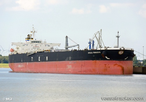
 URAGA PRINCESS
Current Status
Where is the vessel?
URAGA PRINCESS is currently in Near Map Ta Phut, based on AIS data received less than 1h ago.
Latest AIS update:
Current position: 12.57392° N, 101.19705° E (Near Map Ta Phut)
Average speed (last 7 days): Loading…
Average speed (last 30 days): Loading…
Vessel profile: URAGA PRINCESS is a Crude Oil Tanker with dimensions m x m.
This page combines live AIS, route history, probable destination signals, nearby traffic, and port activity for practical vessel monitoring.
The current position of vessel URAGA PRINCESS is 12.57392 lat / 101.19705 lng. Updated: 2026-04-30 19:31:52 UTCNearest reference points:
- 11 nm S of Map Ta Phut
- Near SATTAHIP
- 33 nm S of SATTAHIP
Details:
Live Vessel URAGA PRINCESS Analytics (details, animations, etc.)
Recent AIS points (UTC):
2026-04-30 15:43:52 UTC · 12.57383, 101.19790 · SOG 0.1 kn · COG 218°2026-04-30 16:13:52 UTC · 12.57400, 101.19740 · SOG 0 kn · COG 198°
2026-04-30 17:31:52 UTC · 12.57403, 101.19738 · SOG 0 kn · COG 195°
2026-04-30 19:31:52 UTC · 12.57392, 101.19705 · SOG 0 kn · COG 187°