 vesseltracker.com
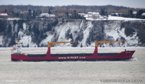
 PUKA
PUKA
Current Status
Where is the vessel?
PUKA is currently in Near Port de Fort-de-France Pt., based on AIS data received about 2h ago.
Latest AIS update:
Current position: 14.59358° N, 61.05077° W (Near Port de Fort-de-France Pt.)
Average speed (last 7 days): Loading…
Average speed (last 30 days): Loading…
Vessel profile: PUKA is a General Cargo with dimensions m x m.
This page combines live AIS, route history, probable destination signals, nearby traffic, and port activity for practical vessel monitoring.
The current position of vessel PUKA is 14.59358 lat / -61.05077 lng. Updated: 2026-04-26 02:08:51 UTCNearest reference points:
- Near Fort De France
- Near LE MARIN
- Near Gros Islet
Details:
Live Vessel PUKA Analytics (details, animations, etc.)
Recent AIS points (UTC):
2026-04-25 22:50:47 UTC · 14.59357, -61.05078 · SOG 0 kn · COG 169°2026-04-25 23:23:49 UTC · 14.59352, -61.05088 · SOG 0 kn · COG 169°
2026-04-26 01:41:57 UTC · 14.59362, -61.05083 · SOG 0 kn · COG 169°
2026-04-26 02:08:51 UTC · 14.59358, -61.05077 · SOG 0 kn · COG 169°