 vesseltracker.com
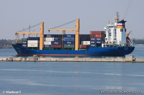
 IONIA
IONIA
Current Status
Where is the vessel?
IONIA is currently in 24 nm NW of Haifa Granaries, based on AIS data received about 1h ago.
Latest AIS update:
Current position: 32.95668° N, 34.55446° E (24 nm NW of Haifa Granaries)
Average speed (last 7 days): Loading…
Average speed (last 30 days): Loading…
Vessel profile: IONIA is a Container Ship with dimensions m x m.
This page combines live AIS, route history, probable destination signals, nearby traffic, and port activity for practical vessel monitoring.
The current position of vessel IONIA is 32.95668 lat / 34.55446 lng. Updated: 2026-05-14 19:48:23 UTCNearest reference points:
- 22 nm W of Haifa Granaries
- Near Haifa
- Near DBAIYEH
Details:
Live Vessel IONIA Analytics (details, animations, etc.)
Recent AIS points (UTC):
2026-05-14 16:07:13 UTC · 32.82982, 35.02631 · SOG 0 kn · COG 353°2026-05-14 18:23:23 UTC · 32.89502, 34.89539 · SOG 13.1 kn · COG 283°
2026-05-14 19:41:23 UTC · 32.95144, 34.58152 · SOG 12 kn · COG 285°
2026-05-14 19:48:23 UTC · 32.95668, 34.55446 · SOG 11.9 kn · COG 285°