 vesseltracker.com
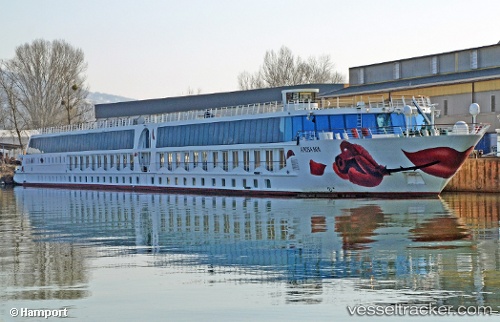
 A Rosa Mia
Current Status
Where is the vessel?
A Rosa Mia is currently in Near Grafenworth, based on AIS data received about 1h ago.
Latest AIS update:
Current position: 48.37150° N, 15.74796° E (Near Grafenworth)
Average speed (last 7 days): Loading…
Average speed (last 30 days): Loading…
Vessel profile: A Rosa Mia is a Passenger Ship with dimensions 125m x 15m.
This page combines live AIS, route history, probable destination signals, nearby traffic, and port activity for practical vessel monitoring.
The current position of vessel A Rosa Mia is 48.37150 lat / 15.74796 lng. Updated: 2026-05-01 06:22:13 UTCNearest reference points:
- Near Ybbs an der Donau
- Near Langenstein
- Near Steyregg
Currently sailing under the flag of Germany ![]()
Details:
Live Vessel A Rosa Mia Analytics (details, animations, etc.)
Recent AIS points (UTC):
2026-05-01 02:29:56 UTC · 48.17204, 15.09850 · SOG 12.1 kn · COG -1°2026-05-01 03:42:10 UTC · 48.22625, 15.30227 · SOG 0 kn · COG -1°
2026-05-01 04:09:03 UTC · 48.25162, 15.36253 · SOG 11.5 kn · COG -1°
2026-05-01 06:22:13 UTC · 48.37150, 15.74796 · SOG 9.7 kn · COG -1°