 vesseltracker.com
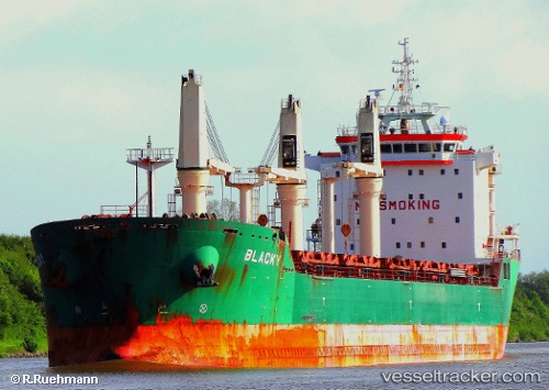
 Blacky
Current Status
Where is the vessel?
Blacky is currently in 219 nm E of Ilha de Itamaracá, based on AIS data received less than 1h ago.
Latest AIS update:
Current position: 7.95095° S, 31.14812° W (219 nm E of Ilha de Itamaracá)
Average speed (last 7 days): Loading…
Average speed (last 30 days): Loading…
Vessel profile: Blacky is a Bulk Carrier with dimensions 185m x 24m.
This page combines live AIS, route history, probable destination signals, nearby traffic, and port activity for practical vessel monitoring.
The current position of vessel Blacky is -7.95095 lat / -31.14812 lng. Updated: 2026-05-15 03:15:31 UTCCurrently sailing under the flag of Cyprus ![]()
Blacky built in 2008 year
Deadweight:
30801 tDetails:
Live Vessel Blacky Analytics (details, animations, etc.)
Recent AIS points (UTC):
2026-05-14 21:39:42 UTC · -6.97304, -30.53233 · SOG 12.7 kn · COG 211°2026-05-14 22:25:22 UTC · -7.10797, -30.62036 · SOG 12.9 kn · COG 211°
2026-05-14 23:50:00 UTC · -7.35667, -30.78167 · SOG 12 kn · COG -1°
2026-05-15 03:15:31 UTC · -7.95095, -31.14812 · SOG 11.9 kn · COG 210°