 vesseltracker.com
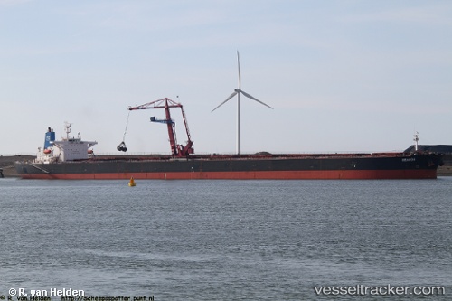
 CAPE NATALIE
Current Status
Where is the vessel?
CAPE NATALIE is currently in 65 nm SW of King Abdullah City, based on AIS data received about 1145d ago.
Latest AIS update:
Current position: 21.96226° N, 38.00469° E (65 nm SW of King Abdullah City)
Average speed (last 7 days): Loading…
Average speed (last 30 days): Loading…
Vessel profile: CAPE NATALIE is a Bulk Carrier with dimensions 24m x 3m.
This page combines live AIS, route history, probable destination signals, nearby traffic, and port activity for practical vessel monitoring.
The current position of vessel CAPE NATALIE is 21.96226 lat / 38.00469 lng. Updated: 2023-03-06 18:29:30 UTCNearest reference points:
- 65 nm SW of King Abdullah City
- 67 nm W of Tusdeer Free Zone
- 64 nm W of Tusdeer Free Zone
Currently sailing under the flag of Cyprus ![]()
CAPE NATALIE built in 2000 year
Deadweight:
172247 tDetails:
Live Vessel CAPE NATALIE Analytics (details, animations, etc.)
Recent AIS points (UTC):
2023-03-06 18:29:30 UTC · 21.96226, 38.00469 · SOG 6.9 kn · COG 334°