 vesseltracker.com
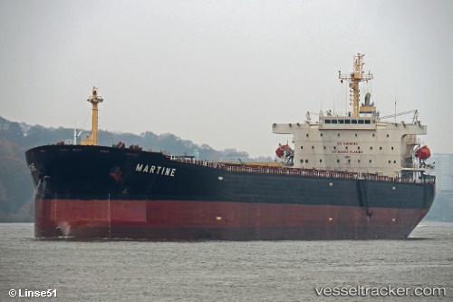
 Martine
Current Status
Where is the vessel?
Martine is currently in 14 nm SE of Gageohyangri, based on AIS data received less than 1h ago.
Latest AIS update:
Current position: 33.96610° N, 125.33400° E (14 nm SE of Gageohyangri)
Average speed (last 7 days): Loading…
Average speed (last 30 days): Loading…
Vessel profile: Martine is a Bulk Carrier with dimensions 229m x 37m.
This page combines live AIS, route history, probable destination signals, nearby traffic, and port activity for practical vessel monitoring.
The current position of vessel Martine is 33.96610 lat / 125.33400 lng. Updated: 2026-05-14 04:27:24 UTCNearest reference points:
- 17 nm W of Chuja
- 47 nm W of Hallim
- 13 nm NW of Aewol
Currently sailing under the flag of Cyprus ![]()
Martine built in 2009 year
Deadweight:
86800 tDetails:
Live Vessel Martine Analytics (details, animations, etc.)
Recent AIS points (UTC):
2026-05-14 01:43:56 UTC · 34.45373, 125.03972 · SOG 11.5 kn · COG 162°2026-05-14 01:49:24 UTC · 34.43715, 125.04650 · SOG 11.6 kn · COG 161°
2026-05-14 03:35:46 UTC · 34.12900, 125.23383 · SOG 12.3 kn · COG 155°
2026-05-14 04:27:24 UTC · 33.96610, 125.33400 · SOG 13 kn · COG 154°