 vesseltracker.com
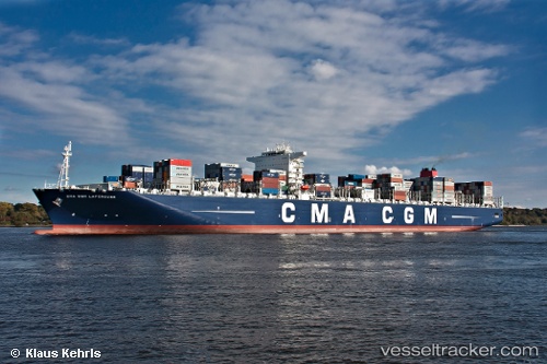
 CMA CGM LAPEROUSE
Current Status
Where is the vessel?
CMA CGM LAPEROUSE is currently in 130 nm E of Tan Cang Qui Nhon, based on AIS data received less than 1h ago.
Latest AIS update:
Current position: 14.45500° N, 111.94100° E (130 nm E of Tan Cang Qui Nhon)
Average speed (last 7 days): Loading…
Average speed (last 30 days): Loading…
Vessel profile: CMA CGM LAPEROUSE is a Container Ship with dimensions 365m x 52m.
This page combines live AIS, route history, probable destination signals, nearby traffic, and port activity for practical vessel monitoring.
The current position of vessel CMA CGM LAPEROUSE is 14.455 lat / 111.941 lng. Updated: 2026-04-29 16:59:23 UTCNearest reference points:
- 215 nm NE of Tan Cang Qui Nhon
- 222 nm E of Tan Cang Qui Nhon
- 232 nm E of Tan Cang Qui Nhon
Currently sailing under the flag of Malta ![]()
CMA CGM LAPEROUSE built in 2010 year
Deadweight:
165422 tDetails:
Live Vessel CMA CGM LAPEROUSE Analytics (details, animations, etc.)
Recent AIS points (UTC):
2026-04-29 13:09:52 UTC · 13.69500, 111.41500 · SOG 14.9 kn · COG 35°2026-04-29 13:29:16 UTC · 13.76150, 111.46200 · SOG 14.8 kn · COG 35°
2026-04-29 16:11:52 UTC · 14.29500, 111.83800 · SOG 14 kn · COG -1°
2026-04-29 16:59:23 UTC · 14.45500, 111.94100 · SOG 14.1 kn · COG 33°