 vesseltracker.com
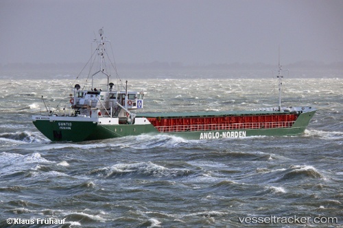
 Suntis
Current Status
Where is the vessel?
Suntis is currently in 14 nm N of Wieck auf dem Dass, based on AIS data received about 2h ago.
Latest AIS update:
Current position: 54.63510° N, 12.43680° E (14 nm N of Wieck auf dem Dass)
Average speed (last 7 days): Loading…
Average speed (last 30 days): Loading…
Vessel profile: Suntis is a Multi Purpose Carrier with dimensions 82m x 11m.
This page combines live AIS, route history, probable destination signals, nearby traffic, and port activity for practical vessel monitoring.
The current position of vessel Suntis is 54.6351 lat / 12.4368 lng. Updated: 2026-05-15 01:15:52 UTCNearest reference points:
- Near Pruchten
- 10 nm NW of Graal-Müritz
- Near Warnemunde
Currently sailing under the flag of Germany ![]()
Suntis built in 1985 year
Deadweight:
1815 tDetails:
Live Vessel Suntis Analytics (details, animations, etc.)
Recent AIS points (UTC):
2026-05-14 22:01:01 UTC · 54.41090, 11.73240 · SOG 10 kn · COG 116°2026-05-14 22:37:22 UTC · 54.39890, 11.90090 · SOG 10.1 kn · COG 92°
2026-05-14 23:58:42 UTC · 54.45780, 12.24570 · SOG 10.1 kn · COG 34°
2026-05-15 01:15:52 UTC · 54.63510, 12.43680 · SOG 10.3 kn · COG 58°