 vesseltracker.com
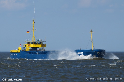
 Amanda
Current Status
Where is the vessel?
Amanda is currently in Near Aarhus, based on AIS data received less than 1h ago.
Latest AIS update:
Current position: 56.14640° N, 10.21430° E (Near Aarhus)
Average speed (last 7 days): Loading…
Average speed (last 30 days): Loading…
Vessel profile: Amanda is a General Cargo Ship with dimensions 81m x 11m.
This page combines live AIS, route history, probable destination signals, nearby traffic, and port activity for practical vessel monitoring.
The current position of vessel Amanda is 56.1464 lat / 10.2143 lng. Updated: 2026-04-07 19:57:50 UTCNearest reference points:
- Near Randers
- Near Horsens
- Near Glesborg
Currently sailing under the flag of Denmark ![]()
Amanda built in 1981 year
Deadweight:
1795 tDetails:
Live Vessel Amanda Analytics (details, animations, etc.)
Recent AIS points (UTC):
2026-04-07 14:13:49 UTC · 56.14640, 10.21430 · SOG 0 kn · COG 35°2026-04-07 16:21:59 UTC · 56.14640, 10.21430 · SOG 0 kn · COG 35°
2026-04-07 17:51:30 UTC · 56.14640, 10.21430 · SOG 0 kn · COG 35°
2026-04-07 19:57:50 UTC · 56.14640, 10.21430 · SOG 0 kn · COG 35°