 vesseltracker.com
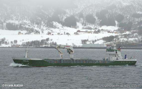
 AMALIE
Current Status
Where is the vessel?
AMALIE is currently in Near Kristiansund, based on AIS data received less than 1h ago.
Latest AIS update:
Current position: 63.15745° N, 7.74753° E (Near Kristiansund)
Average speed (last 7 days): Loading…
Average speed (last 30 days): Loading…
Vessel profile: AMALIE is a General Cargo Ship with dimensions m x m.
This page combines live AIS, route history, probable destination signals, nearby traffic, and port activity for practical vessel monitoring.
The current position of vessel AMALIE is 63.15745 lat / 7.74753 lng. Updated: 2026-05-15 16:41:51 UTCNearest reference points:
- Near Kristiansund
- Near Smøla
- Near Halsa
Currently sailing under the flag of Denmark (DIS) ![]()
AMALIE built in 1997 year
Deadweight:
2035 tDetails:
Live Vessel AMALIE Analytics (details, animations, etc.)
Recent AIS points (UTC):
2026-05-15 13:09:57 UTC · 63.05666, 7.67002 · SOG 0 kn · COG 34°2026-05-15 13:26:55 UTC · 63.05666, 7.67005 · SOG 0 kn · COG 33°
2026-05-15 15:32:53 UTC · 63.05666, 7.67010 · SOG 0 kn · COG 32°
2026-05-15 16:41:51 UTC · 63.15745, 7.74753 · SOG 10.2 kn · COG 50°