 vesseltracker.com
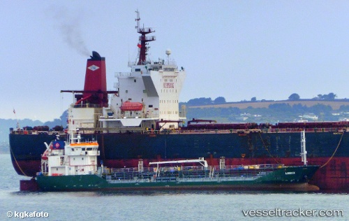
 ANDREA
Current Status
Where is the vessel?
ANDREA is currently in Near Kalundborg, based on AIS data received less than 1h ago.
Latest AIS update:
Current position: 55.67317° N, 11.09693° E (Near Kalundborg)
Average speed (last 7 days): Loading…
Average speed (last 30 days): Loading…
Vessel profile: ANDREA is a Oil Products Tanker with dimensions 77m x 11m.
This page combines live AIS, route history, probable destination signals, nearby traffic, and port activity for practical vessel monitoring.
The current position of vessel ANDREA is 55.67317 lat / 11.09693 lng. Updated: 2026-05-16 15:31:01 UTCNearest reference points:
- Near Kalundborg
- Near Eskebjerg
- Near Lindholm Havn
Currently sailing under the flag of Denmark ![]()
ANDREA built in 2008 year
Deadweight:
1942 tDetails:
Live Vessel ANDREA Analytics (details, animations, etc.)
Recent AIS points (UTC):
2026-05-16 12:22:11 UTC · 55.67317, 11.09695 · SOG 0 kn · COG 164°2026-05-16 13:58:13 UTC · 55.67320, 11.09695 · SOG 0 kn · COG 164°
2026-05-16 14:04:12 UTC · 55.67319, 11.09697 · SOG 0 kn · COG 164°
2026-05-16 15:31:01 UTC · 55.67317, 11.09693 · SOG 0 kn · COG 164°