 vesseltracker.com
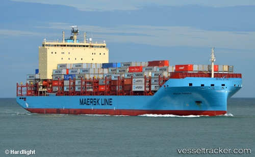
 Volga Maersk
Current Status
Where is the vessel?
Volga Maersk is currently in 193 nm SE of Lower Sackville, based on AIS data received about 1h ago.
Latest AIS update:
Current position: 43.86575° N, 39.28060° W (193 nm SE of Lower Sackville)
Average speed (last 7 days): Loading…
Average speed (last 30 days): Loading…
Vessel profile: Volga Maersk is a Container Ship with dimensions 200m x 200m.
This page combines live AIS, route history, probable destination signals, nearby traffic, and port activity for practical vessel monitoring.
The current position of vessel Volga Maersk is 43.86575 lat / -39.28060 lng. Updated: 2026-05-13 23:37:27 UTCCurrently sailing under the flag of Denmark ![]()
Details:
Live Vessel Volga Maersk Analytics (details, animations, etc.)
Recent AIS points (UTC):
2026-05-13 19:54:37 UTC · 43.59667, -40.05333 · SOG 9 kn · COG -1°2026-05-13 21:45:57 UTC · 43.72500, -39.68167 · SOG 10 kn · COG -1°
2026-05-13 22:31:02 UTC · 43.78167, -39.52167 · SOG 10 kn · COG -1°
2026-05-13 23:37:27 UTC · 43.86575, -39.28060 · SOG 10.6 kn · COG 65°