 vesseltracker.com
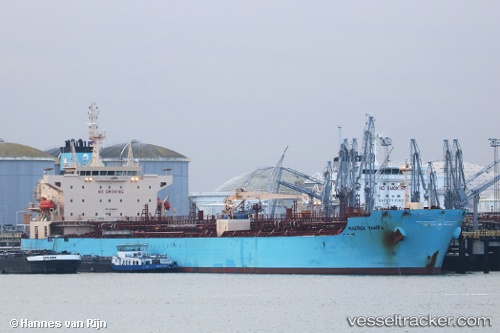
 Maersk Tampa
Current Status
Where is the vessel?
Maersk Tampa is currently in Near Pasadena, based on AIS data received about 1h ago.
Latest AIS update:
Current position: 29.72542° N, 95.21990° W (Near Pasadena)
Average speed (last 7 days): Loading…
Average speed (last 30 days): Loading…
Vessel profile: Maersk Tampa is a Chemical Oil Products Tanker with dimensions 183m x 32m.
This page combines live AIS, route history, probable destination signals, nearby traffic, and port activity for practical vessel monitoring.
The current position of vessel Maersk Tampa is 29.72542 lat / -95.21990 lng. Updated: 2026-04-26 01:58:30 UTCNearest reference points:
- Near Pasadena
- Near Jacinto City
- Near Morgan Point
Currently sailing under the flag of Denmark ![]()
Details:
Live Vessel Maersk Tampa Analytics (details, animations, etc.)
Recent AIS points (UTC):
2026-04-25 22:58:29 UTC · 29.72547, -95.21992 · SOG 0 kn · COG 95°2026-04-26 00:19:30 UTC · 29.72545, -95.21993 · SOG 0 kn · COG 95°
2026-04-26 01:28:29 UTC · 29.72546, -95.21992 · SOG 0 kn · COG 95°
2026-04-26 01:58:30 UTC · 29.72542, -95.21990 · SOG 0 kn · COG 95°