 vesseltracker.com
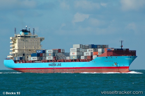
 Maersk Norfolk
Current Status
Where is the vessel?
Maersk Norfolk is currently in 65 nm NE of Darnah, based on AIS data received less than 1h ago.
Latest AIS update:
Current position: 33.46155° N, 23.63040° E (65 nm NE of Darnah)
Average speed (last 7 days): Loading…
Average speed (last 30 days): Loading…
Vessel profile: Maersk Norfolk is a Container Ship with dimensions 211m x 30m.
This page combines live AIS, route history, probable destination signals, nearby traffic, and port activity for practical vessel monitoring.
The current position of vessel Maersk Norfolk is 33.46155 lat / 23.63040 lng. Updated: 2026-04-30 18:00:12 UTCNearest reference points:
- 67 nm S of Kali Limenes
- Near Kali Limenes
- 59 nm W of Paleochora
Currently sailing under the flag of Denmark ![]()
Maersk Norfolk built in 2008 year
Deadweight:
35205 tDetails:
Live Vessel Maersk Norfolk Analytics (details, animations, etc.)
Recent AIS points (UTC):
2026-04-30 14:03:01 UTC · 33.01745, 24.87187 · SOG 18.2 kn · COG 295°2026-04-30 16:17:07 UTC · 33.28077, 24.14152 · SOG 16 kn · COG 293°
2026-04-30 16:46:37 UTC · 33.33033, 23.99641 · SOG 16 kn · COG 296°
2026-04-30 18:00:12 UTC · 33.46155, 23.63040 · SOG 16.2 kn · COG 296°