 vesseltracker.com
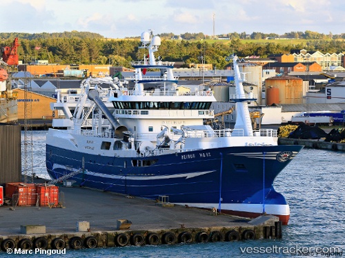
 Beinur
Current Status
Where is the vessel?
Beinur is currently in Near Hirtshals, based on AIS data received less than 1h ago.
Latest AIS update:
Current position: 57.59245° N, 9.97276° E (Near Hirtshals)
Average speed (last 7 days): Loading…
Average speed (last 30 days): Loading…
Vessel profile: Beinur is a Fishing Vessel with dimensions 78m x 78m.
This page combines live AIS, route history, probable destination signals, nearby traffic, and port activity for practical vessel monitoring.
The current position of vessel Beinur is 57.59245 lat / 9.97276 lng. Updated: 2026-05-16 05:26:56 UTCNearest reference points:
- Near Hirtshals
- 15 nm N of Hirtshals
- Near SKAGEN
Currently sailing under the flag of Denmark ![]()
Details:
Live Vessel Beinur Analytics (details, animations, etc.)
Recent AIS points (UTC):
2026-05-16 01:50:38 UTC · 57.59239, 9.97278 · SOG 0 kn · COG 132°2026-05-16 03:22:45 UTC · 57.59254, 9.97278 · SOG 0 kn · COG 132°
2026-05-16 04:03:16 UTC · 57.59245, 9.97282 · SOG 0 kn · COG 132°
2026-05-16 05:26:56 UTC · 57.59245, 9.97276 · SOG 0 kn · COG 131°