 vesseltracker.com
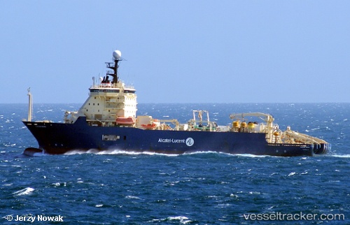
Ile De Sein
Current StatusWhere is the vessel?
Ile De Sein is currently in 194 nm W of Raichur, based on AIS data received about 2h ago.
Latest AIS update:
Current position: 15.99897° N, 80.71798° W (194 nm W of Raichur)
Average speed (last 7 days): Loading…
Average speed (last 30 days): Loading…
Vessel profile: Ile De Sein is a Cable Layer with dimensions 24m x 140m.
This page combines live AIS, route history, probable destination signals, nearby traffic, and port activity for practical vessel monitoring.
The current position of vessel Ile De Sein is 15.99897 lat / -80.71798 lng. Updated: 2026-04-29 00:41:47 UTCDetails:
Live Vessel Ile De Sein Analytics (details, animations, etc.)
Recent AIS points (UTC):
2026-04-28 21:14:52 UTC · 15.99885, -80.71815 · SOG 0 kn · COG 140°2026-04-28 21:14:52 UTC · 15.99885, -80.71815 · SOG 0 kn · COG 140°
2026-04-29 00:41:47 UTC · 15.99897, -80.71798 · SOG 0 kn · COG 125°
2026-04-29 00:41:47 UTC · 15.99897, -80.71798 · SOG 0 kn · COG 125°