 vesseltracker.com
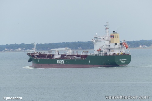
 Skuteviken
Current Status
Where is the vessel?
Skuteviken is currently in Near ZAANDAM, based on AIS data received less than 1h ago.
Latest AIS update:
Current position: 52.41172° N, 4.84509° E (Near ZAANDAM)
Average speed (last 7 days): Loading…
Average speed (last 30 days): Loading…
Vessel profile: Skuteviken is a Chemical Tanker with dimensions 130m x 20m.
This page combines live AIS, route history, probable destination signals, nearby traffic, and port activity for practical vessel monitoring.
The current position of vessel Skuteviken is 52.41172 lat / 4.84509 lng. Updated: 2026-05-14 05:44:25 UTCNearest reference points:
- Near ZAANDAM
- Near Amsterdam
- Near Zaanstad
Currently sailing under the flag of France ![]()
Details:
Live Vessel Skuteviken Analytics (details, animations, etc.)
Recent AIS points (UTC):
2026-05-14 01:29:22 UTC · 52.41172, 4.84508 · SOG 0 kn · COG 344°2026-05-14 03:41:24 UTC · 52.41172, 4.84510 · SOG 0 kn · COG 344°
2026-05-14 04:32:48 UTC · 52.41172, 4.84508 · SOG 0 kn · COG 344°
2026-05-14 05:44:25 UTC · 52.41172, 4.84509 · SOG 0 kn · COG 344°