 vesseltracker.com
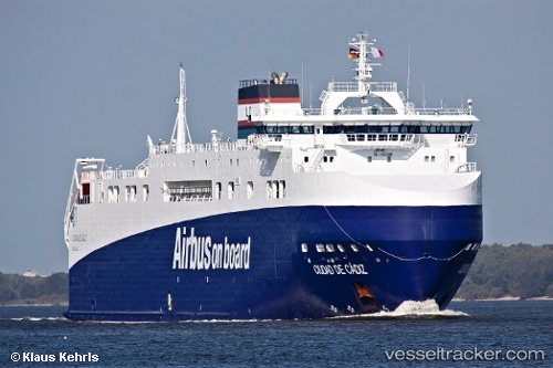
Ciudad De Cadiz
Current StatusWhere is the vessel?
Ciudad De Cadiz is currently in 25 nm SE of Carchuna, based on AIS data received less than 1h ago.
Latest AIS update:
Current position: 36.30755° N, 3.23153° W (25 nm SE of Carchuna)
Average speed (last 7 days): Loading…
Average speed (last 30 days): Loading…
Vessel profile: Ciudad De Cadiz is a Ro Ro Cargo Ship with dimensions 25m x 125m.
This page combines live AIS, route history, probable destination signals, nearby traffic, and port activity for practical vessel monitoring.
The current position of vessel Ciudad De Cadiz is 36.30755 lat / -3.23153 lng. Updated: 2026-05-02 17:43:14 UTCNearest reference points:
- 29 nm S of Carchuna
- 23 nm S of Carchuna
- Near ADRA
Details:
Live Vessel Ciudad De Cadiz Analytics (details, animations, etc.)
Recent AIS points (UTC):
2026-05-02 14:10:31 UTC · 36.47781, -2.07119 · SOG 16.5 kn · COG 245°2026-05-02 16:16:55 UTC · 36.35001, -2.76686 · SOG 15.5 kn · COG 257°
2026-05-02 16:53:20 UTC · 36.33638, -2.96089 · SOG 15.5 kn · COG 267°
2026-05-02 17:43:14 UTC · 36.30755, -3.23153 · SOG 15.9 kn · COG 262°