 vesseltracker.com
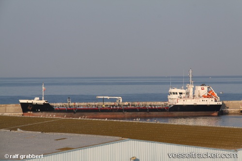
 Cap Pinede
Current Status
Where is the vessel?
Cap Pinede is currently in Near Port-de-Bouc, based on AIS data received less than 1h ago.
Latest AIS update:
Current position: 43.40433° N, 4.98967° E (Near Port-de-Bouc)
Average speed (last 7 days): Loading…
Average speed (last 30 days): Loading…
Vessel profile: Cap Pinede is a Chemical Oil Products Tanker with dimensions 89m x 89m.
This page combines live AIS, route history, probable destination signals, nearby traffic, and port activity for practical vessel monitoring.
The current position of vessel Cap Pinede is 43.40433 lat / 4.98967 lng. Updated: 2026-04-25 16:22:37 UTCNearest reference points:
- Near Fos-sur-Mer
- Near SAINT LOUIS DU RHONE
- Near Marseille
Currently sailing under the flag of France ![]()
Cap Pinede built in 2009 year
Deadweight:
3536 tDetails:
Live Vessel Cap Pinede Analytics (details, animations, etc.)
Recent AIS points (UTC):
2026-04-25 13:34:18 UTC · 43.39533, 4.98950 · SOG 0.1 kn · COG 138°2026-04-25 14:05:35 UTC · 43.39533, 4.98950 · SOG 0 kn · COG 138°
2026-04-25 15:30:26 UTC · 43.39534, 4.98956 · SOG 0 kn · COG 138°
2026-04-25 16:22:37 UTC · 43.40433, 4.98967 · SOG 0 kn · COG 3°