 vesseltracker.com
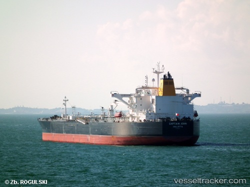
 Captain John
Current Status
Where is the vessel?
Captain John is currently in 234 nm S of Southampton, based on AIS data received about 1h ago.
Latest AIS update:
Current position: 28.36244° N, 64.70434° W (234 nm S of Southampton)
Average speed (last 7 days): Loading…
Average speed (last 30 days): Loading…
Vessel profile: Captain John is a Crude Oil Tanker with dimensions 251m x 45m.
This page combines live AIS, route history, probable destination signals, nearby traffic, and port activity for practical vessel monitoring.
The current position of vessel Captain John is 28.36244 lat / -64.70434 lng. Updated: 2026-05-14 17:20:29 UTCNearest reference points:
- 328 nm W of Villa Elisa
Currently sailing under the flag of Malta ![]()
Details:
Live Vessel Captain John Analytics (details, animations, etc.)
Recent AIS points (UTC):
2026-05-14 13:37:57 UTC · 28.17620, -65.57291 · SOG 12.8 kn · COG 77°2026-05-14 15:42:09 UTC · 28.27816, -65.08247 · SOG 13 kn · COG 76°
2026-05-14 16:19:49 UTC · 28.30983, -64.93679 · SOG 12.6 kn · COG 76°
2026-05-14 17:20:29 UTC · 28.36244, -64.70434 · SOG 12.6 kn · COG 76°