 vesseltracker.com
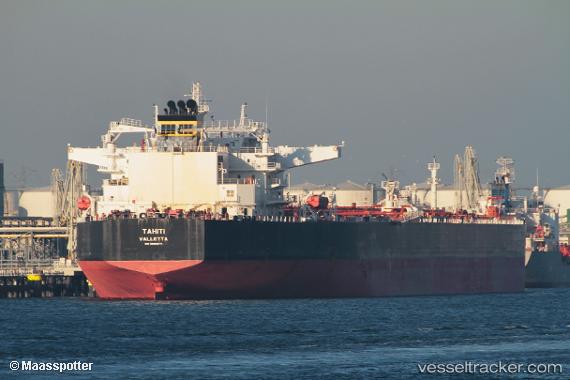
Tahiti
Current StatusWhere is the vessel?
Tahiti is currently in 24 nm SE of Cape Carbonara, based on AIS data received less than 1h ago.
Latest AIS update:
Current position: 38.75920° N, 9.78950° E (24 nm SE of Cape Carbonara)
Average speed (last 7 days): Loading…
Average speed (last 30 days): Loading…
Vessel profile: Tahiti is a Crude Oil Tanker with dimensions 48m x 273m.
This page combines live AIS, route history, probable destination signals, nearby traffic, and port activity for practical vessel monitoring.
The current position of vessel Tahiti is 38.75920 lat / 9.78950 lng. Updated: 2026-04-20 00:18:36 UTCNearest reference points:
- Near SARROCH
- Near Cagliari
- 33 nm SE of Setubal
Details:
Live Vessel Tahiti Analytics (details, animations, etc.)
Recent AIS points (UTC):
2026-04-19 19:51:06 UTC · 38.29944, 10.74175 · SOG 10.8 kn · COG 300°2026-04-19 21:41:15 UTC · 38.48936, 10.34944 · SOG 11.8 kn · COG 303°
2026-04-19 22:30:56 UTC · 38.57678, 10.17287 · SOG 11.7 kn · COG 300°
2026-04-20 00:18:36 UTC · 38.75920, 9.78950 · SOG 11.9 kn · COG 303°