 vesseltracker.com
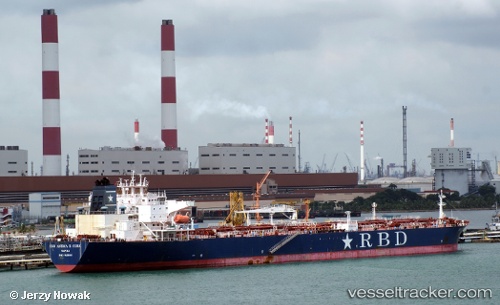
 PS AMALFI
Current Status
Where is the vessel?
PS AMALFI is currently in 20 nm W of West End, based on AIS data received about 1h ago.
Latest AIS update:
Current position: 26.65827° N, 79.34696° W (20 nm W of West End)
Average speed (last 7 days): Loading…
Average speed (last 30 days): Loading…
Vessel profile: PS AMALFI is a Crude Oil Tanker with dimensions 42m x 243m.
This page combines live AIS, route history, probable destination signals, nearby traffic, and port activity for practical vessel monitoring.
The current position of vessel PS AMALFI is 26.65827 lat / -79.34696 lng. Updated: 2026-05-15 13:45:59 UTCNearest reference points:
- Near Palm Beach
- Near Rivera Beach
- Near Lake Park
Currently sailing under the flag of Malta ![]()
PS AMALFI built in 2010 year
Deadweight:
108958 tDetails:
Live Vessel PS AMALFI Analytics (details, animations, etc.)
Recent AIS points (UTC):
2026-05-15 10:53:59 UTC · 27.09500, -79.31333 · SOG 9 kn · COG -1°2026-05-15 11:26:58 UTC · 27.01167, -79.32000 · SOG 9 kn · COG -1°
2026-05-15 13:45:59 UTC · 26.65827, -79.34696 · SOG 9 kn · COG 184°
2026-05-15 13:45:59 UTC · 26.65827, -79.34696 · SOG 9 kn · COG 184°