 vesseltracker.com
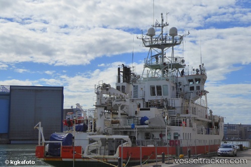
 Aranda
Current Status
Where is the vessel?
Aranda is currently in 12 nm SE of Porkkala, based on AIS data received about 1h ago.
Latest AIS update:
Current position: 59.86249° N, 24.79566° E (12 nm SE of Porkkala)
Average speed (last 7 days): Loading…
Average speed (last 30 days): Loading…
Vessel profile: Aranda is a Research Vessel with dimensions 66m x 14m.
This page combines live AIS, route history, probable destination signals, nearby traffic, and port activity for practical vessel monitoring.
The current position of vessel Aranda is 59.86249 lat / 24.79566 lng. Updated: 2026-05-14 16:07:53 UTCNearest reference points:
- Near Nurme
- Near Esbo (Espoo)
- Near Suomenlinna (Sveaborg)
Currently sailing under the flag of Finland ![]()
Aranda built in 1989 year
Details:
Live Vessel Aranda Analytics (details, animations, etc.)
Recent AIS points (UTC):
2026-05-14 13:33:53 UTC · 59.49345, 24.56448 · SOG 11.6 kn · COG 335°2026-05-14 13:55:14 UTC · 59.54074, 24.47903 · SOG 10.6 kn · COG 316°
2026-05-14 16:01:59 UTC · 59.84751, 24.77749 · SOG 10.7 kn · COG 36°
2026-05-14 16:07:53 UTC · 59.86249, 24.79566 · SOG 10.7 kn · COG 36°