 vesseltracker.com
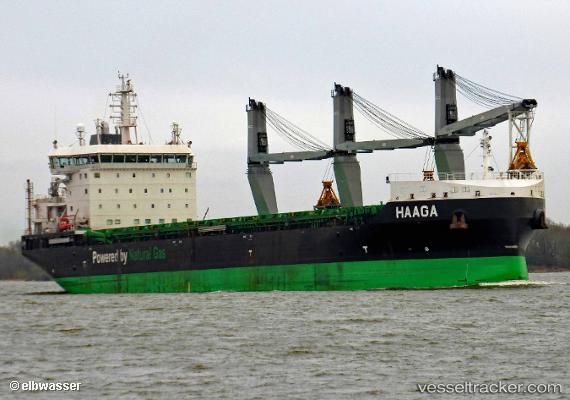
 Haaga
Haaga
Current Status
Where is the vessel?
Haaga is currently in Near Musel-Arnao, based on AIS data received less than 1h ago.
Latest AIS update:
Current position: 43.58045° N, 5.68501° W (Near Musel-Arnao)
Average speed (last 7 days): Loading…
Average speed (last 30 days): Loading…
Vessel profile: Haaga is a Bulk Carrier with dimensions 160m x 26m.
This page combines live AIS, route history, probable destination signals, nearby traffic, and port activity for practical vessel monitoring.
The current position of vessel Haaga is 43.58045 lat / -5.68501 lng. Updated: 2026-04-28 22:29:23 UTCNearest reference points:
- Near Musel-Arnao
- Near Tremanes
- Near San Juan de Nieva
Currently sailing under the flag of Finland ![]()
Details:
Live Vessel Haaga Analytics (details, animations, etc.)
Recent AIS points (UTC):
2026-04-28 18:05:25 UTC · 43.58043, -5.68503 · SOG 0 kn · COG 249°2026-04-28 19:53:31 UTC · 43.58042, -5.68506 · SOG 0 kn · COG 250°
2026-04-28 21:32:26 UTC · 43.58046, -5.68502 · SOG 0 kn · COG 251°
2026-04-28 22:29:23 UTC · 43.58045, -5.68501 · SOG 0 kn · COG 251°