 vesseltracker.com
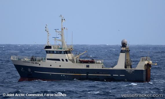
Hamranes
Current StatusWhere is the vessel?
Hamranes is currently in 38 nm S of Vágur, based on AIS data received less than 1h ago.
Latest AIS update:
Current position: 60.83132° N, 6.92474° W (38 nm S of Vágur)
Average speed (last 7 days): Loading…
Average speed (last 30 days): Loading…
Vessel profile: Hamranes is a Fishing Vessel with dimensions 8m x 36m.
This page combines live AIS, route history, probable destination signals, nearby traffic, and port activity for practical vessel monitoring.
The current position of vessel Hamranes is 60.83132 lat / -6.92474 lng. Updated: 2026-05-16 15:41:56 UTCNearest reference points:
- 20 nm S of Vágur
- Near VESTMANNA
- Near FUGLAFJORDUR
Details:
Live Vessel Hamranes Analytics (details, animations, etc.)
Recent AIS points (UTC):
2026-05-16 12:11:57 UTC · 60.66061, -6.80015 · SOG 2.9 kn · COG -1°2026-05-16 13:11:56 UTC · 60.69105, -6.83350 · SOG 4.4 kn · COG -1°
2026-05-16 13:28:40 UTC · 60.70333, -6.85167 · SOG 3 kn · COG -1°
2026-05-16 15:41:56 UTC · 60.83132, -6.92474 · SOG 4.1 kn · COG -1°