 vesseltracker.com
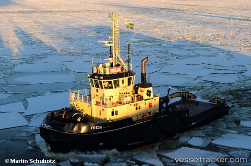
 Freja
Freja
Current Status
Where is the vessel?
Freja is currently in Near NYNASHAMN, based on AIS data received less than 1h ago.
Latest AIS update:
Current position: 58.90063° N, 17.95319° E (Near NYNASHAMN)
Average speed (last 7 days): Loading…
Average speed (last 30 days): Loading…
Vessel profile: Freja is a Tug with dimensions 33m x 11m.
This page combines live AIS, route history, probable destination signals, nearby traffic, and port activity for practical vessel monitoring.
The current position of vessel Freja is 58.90063 lat / 17.95319 lng. Updated: 2026-04-24 01:16:35 UTCNearest reference points:
- Near Stora Vika
- Near SODERTALJE
- Near Segeltorp
Currently sailing under the flag of Faroe Is ![]()
Freja built in 1998 year
Deadweight:
229 tDetails:
Live Vessel Freja Analytics (details, animations, etc.)
Recent AIS points (UTC):
2026-04-23 21:36:21 UTC · 58.90019, 17.95369 · SOG 1.7 kn · COG 30°2026-04-23 22:21:52 UTC · 58.93623, 17.98238 · SOG 0.2 kn · COG 270°
2026-04-24 00:01:35 UTC · 58.90063, 17.95319 · SOG 0 kn · COG 286°
2026-04-24 01:16:35 UTC · 58.90063, 17.95319 · SOG 0 kn · COG 286°