 vesseltracker.com
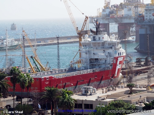
 SITELLA TIDE
Current Status
Where is the vessel?
SITELLA TIDE is currently in 93 nm N of Nieuw Amsterdam, based on AIS data received less than 1h ago.
Latest AIS update:
Current position: 7.37728° N, 55.50097° W (93 nm N of Nieuw Amsterdam)
Average speed (last 7 days): Loading…
Average speed (last 30 days): Loading…
Vessel profile: SITELLA TIDE is a Offshore Supply Ship with dimensions m x m.
This page combines live AIS, route history, probable destination signals, nearby traffic, and port activity for practical vessel monitoring.
The current position of vessel SITELLA TIDE is 7.37728 lat / -55.50097 lng. Updated: 2026-05-01 13:53:06 UTCNearest reference points:
- 38 nm NW of Jarikaba
- Near Paramaribo Zorg en Hoop Airport
- 57 nm NE of Adventure
Currently sailing under the flag of United Kingdom ![]()
Details:
Live Vessel SITELLA TIDE Analytics (details, animations, etc.)
Recent AIS points (UTC):
2026-05-01 09:59:56 UTC · 7.37849, -55.50136 · SOG 0.5 kn · COG 69°2026-05-01 12:05:39 UTC · 7.37835, -55.50138 · SOG 0.3 kn · COG 68°
2026-05-01 13:40:54 UTC · 7.37754, -55.50108 · SOG 0.4 kn · COG 69°
2026-05-01 13:53:06 UTC · 7.37728, -55.50097 · SOG 0.5 kn · COG 69°