 vesseltracker.com
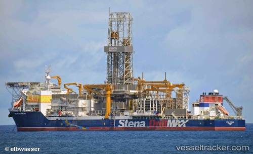
Stena Carron
Current StatusWhere is the vessel?
Stena Carron is currently in 114 nm NE of Enmore, based on AIS data received less than 1h ago.
Latest AIS update:
Current position: 8.46959° N, 57.13363° W (114 nm NE of Enmore)
Average speed (last 7 days): Loading…
Average speed (last 30 days): Loading…
Vessel profile: Stena Carron is a Drilling Ship with dimensions 42m x 228m.
This page combines live AIS, route history, probable destination signals, nearby traffic, and port activity for practical vessel monitoring.
The current position of vessel Stena Carron is 8.46959 lat / -57.13363 lng. Updated: 2026-05-16 08:21:10 UTCNearest reference points:
- 57 nm NE of Adventure
- 38 nm NW of Jarikaba
Details:
Live Vessel Stena Carron Analytics (details, animations, etc.)
Recent AIS points (UTC):
2026-05-16 05:12:22 UTC · 8.46959, -57.13364 · SOG 0.4 kn · COG 126°2026-05-16 05:49:52 UTC · 8.47006, -57.13351 · SOG 0.1 kn · COG 90°
2026-05-16 07:49:56 UTC · 8.46958, -57.13363 · SOG 0.2 kn · COG 125°
2026-05-16 08:21:10 UTC · 8.46959, -57.13363 · SOG 0.5 kn · COG 125°