 vesseltracker.com
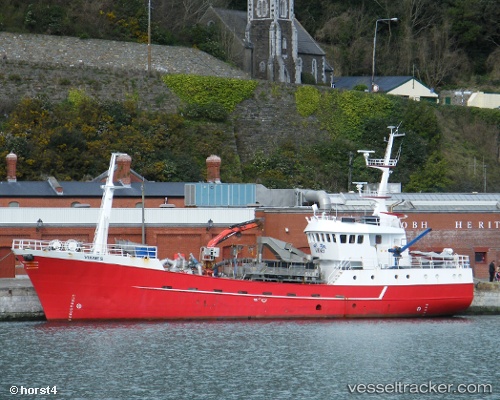
Viking Viknes
Current StatusWhere is the vessel?
Viking Viknes is currently in Near ULLAPOOL, based on AIS data received about 8h ago.
Latest AIS update:
Current position: 57.89880° N, 5.18856° W (Near ULLAPOOL)
Average speed (last 7 days): Loading…
Average speed (last 30 days): Loading…
Vessel profile: Viking Viknes is a Fish Carrier with dimensions 8m x 37m.
This page combines live AIS, route history, probable destination signals, nearby traffic, and port activity for practical vessel monitoring.
The current position of vessel Viking Viknes is 57.89880 lat / -5.18856 lng. Updated: 2026-04-27 12:15:00 UTCNearest reference points:
- Near Culkein
- Near KYLE OF LOCHALSH
- Near Inverness
Details:
Live Vessel Viking Viknes Analytics (details, animations, etc.)
Recent AIS points (UTC):
2026-04-27 12:15:00 UTC · 57.89880, -5.18856 · SOG 10.3 kn · COG 143°2026-04-27 12:15:00 UTC · 57.89880, -5.18856 · SOG 10.3 kn · COG 143°
2026-04-27 12:15:00 UTC · 57.89880, -5.18856 · SOG 10.3 kn · COG 143°
2026-04-27 12:15:00 UTC · 57.89880, -5.18856 · SOG 10.3 kn · COG 143°