 vesseltracker.com
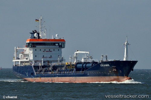
 Ls Jamie
Current Status
Where is the vessel?
Ls Jamie is currently in Near Wilhelmsburg, based on AIS data received less than 1h ago.
Latest AIS update:
Current position: 53.50194° N, 9.95605° E (Near Wilhelmsburg)
Average speed (last 7 days): Loading…
Average speed (last 30 days): Loading…
Vessel profile: Ls Jamie is a Chemical Oil Products Tanker with dimensions 105m x 16m.
This page combines live AIS, route history, probable destination signals, nearby traffic, and port activity for practical vessel monitoring.
The current position of vessel Ls Jamie is 53.50194 lat / 9.95605 lng. Updated: 2026-04-29 05:43:59 UTCNearest reference points:
- Near Bahrenfeld
- Near Hamburg-Mitte
- Near Allermöhe
Currently sailing under the flag of Gibraltar ![]()
Ls Jamie built in 2009 year
Deadweight:
5756 tDetails:
Live Vessel Ls Jamie Analytics (details, animations, etc.)
Recent AIS points (UTC):
2026-04-29 01:36:38 UTC · 53.55427, 9.80101 · SOG 9.6 kn · COG 104°2026-04-29 03:59:17 UTC · 53.50192, 9.95608 · SOG 0 kn · COG 332°
2026-04-29 05:01:55 UTC · 53.50192, 9.95606 · SOG 0 kn · COG 332°
2026-04-29 05:43:59 UTC · 53.50194, 9.95605 · SOG 0 kn · COG 332°