 vesseltracker.com
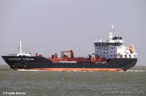
 FRANK
FRANK
Current Status
Where is the vessel?
FRANK is currently in 21 nm E of Broadstairs, based on AIS data received less than 1h ago.
Latest AIS update:
Current position: 51.40843° N, 1.96275° E (21 nm E of Broadstairs)
Average speed (last 7 days): Loading…
Average speed (last 30 days): Loading…
Vessel profile: FRANK is a Oil/Chemical Tanker with dimensions m x m.
This page combines live AIS, route history, probable destination signals, nearby traffic, and port activity for practical vessel monitoring.
The current position of vessel FRANK is 51.40843 lat / 1.96275 lng. Updated: 2026-04-24 10:57:06 UTCNearest reference points:
- 15 nm E of RAMSGATE
- 14 nm SE of RAMSGATE
- Near Calais
Currently sailing under the flag of Gibraltar ![]()
Details:
Live Vessel FRANK Analytics (details, animations, etc.)
Recent AIS points (UTC):
2026-04-24 07:03:59 UTC · 51.49081, 0.87242 · SOG 14.5 kn · COG 90°2026-04-24 07:37:55 UTC · 51.49372, 1.07895 · SOG 13.1 kn · COG 98°
2026-04-24 10:13:17 UTC · 51.48541, 1.77997 · SOG 12.2 kn · COG 87°
2026-04-24 10:57:06 UTC · 51.40843, 1.96275 · SOG 11.9 kn · COG 134°