 vesseltracker.com
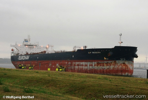
Cap Theodora
Current StatusWhere is the vessel?
Cap Theodora is currently in 113 nm E of Willow Street, based on AIS data received about 1h ago.
Latest AIS update:
Current position: 30.36043° N, 74.19210° W (113 nm E of Willow Street)
Average speed (last 7 days): Loading…
Average speed (last 30 days): Loading…
Vessel profile: Cap Theodora is a Crude Oil Tanker with dimensions 46m x 274m.
This page combines live AIS, route history, probable destination signals, nearby traffic, and port activity for practical vessel monitoring.
The current position of vessel Cap Theodora is 30.36043 lat / -74.19210 lng. Updated: 2026-05-01 19:31:20 UTCNearest reference points:
- 113 nm NE of Green Turtle Cay
Details:
Live Vessel Cap Theodora Analytics (details, animations, etc.)
Recent AIS points (UTC):
2026-05-01 16:10:20 UTC · 29.85633, -74.73773 · SOG 12.1 kn · COG 44°2026-05-01 17:40:47 UTC · 30.07980, -74.49105 · SOG 12.2 kn · COG 44°
2026-05-01 19:31:20 UTC · 30.36043, -74.19210 · SOG 12.4 kn · COG 45°
2026-05-01 19:31:20 UTC · 30.36043, -74.19210 · SOG 12.4 kn · COG 45°