 vesseltracker.com
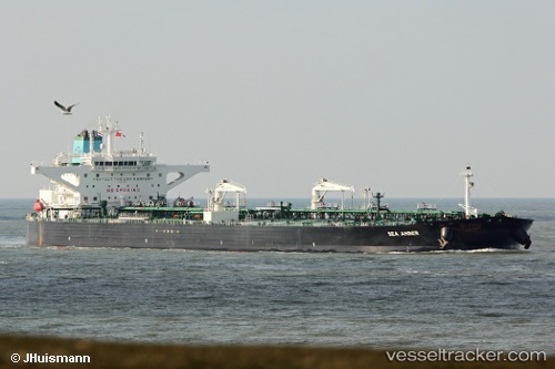
 Sea Amber
Current Status
Where is the vessel?
Sea Amber is currently in 24 nm W of Vescovato, based on AIS data received about 1h ago.
Latest AIS update:
Current position: 42.63334° N, 9.93709° W (24 nm W of Vescovato)
Average speed (last 7 days): Loading…
Average speed (last 30 days): Loading…
Vessel profile: Sea Amber is a Crude Oil Tanker with dimensions 274m x 48m.
This page combines live AIS, route history, probable destination signals, nearby traffic, and port activity for practical vessel monitoring.
The current position of vessel Sea Amber is 42.63334 lat / -9.93709 lng. Updated: 2026-04-08 16:10:08 UTCNearest reference points:
- 40 nm NW of Sarinena
- Near Portosin
- 11 nm S of Sarinena
Currently sailing under the flag of Greece ![]()
Details:
Live Vessel Sea Amber Analytics (details, animations, etc.)
Recent AIS points (UTC):
2026-04-08 10:05:04 UTC · 41.47247, -9.94911 · SOG 11.5 kn · COG -1°2026-04-08 11:40:09 UTC · 41.77572, -9.94831 · SOG 11.6 kn · COG -1°
2026-04-08 14:10:21 UTC · 42.25066, -9.93898 · SOG 11.8 kn · COG 359°
2026-04-08 16:10:08 UTC · 42.63334, -9.93709 · SOG 11.7 kn · COG 0°