 vesseltracker.com
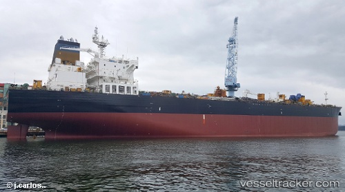
Persepolis
Current StatusWhere is the vessel?
Persepolis is currently in Near Sunset Beach, based on AIS data received less than 1h ago.
Latest AIS update:
Current position: 33.68073° N, 118.12193° W (Near Sunset Beach)
Average speed (last 7 days): Loading…
Average speed (last 30 days): Loading…
Vessel profile: Persepolis is a Crude Oil Tanker with dimensions 32m x 228m.
This page combines live AIS, route history, probable destination signals, nearby traffic, and port activity for practical vessel monitoring.
The current position of vessel Persepolis is 33.68073 lat / -118.12193 lng. Updated: 2026-04-29 05:57:04 UTCNearest reference points:
- Near Seal Beach
- Near SEAL BEACH
- Near Sunset Beach
Details:
Live Vessel Persepolis Analytics (details, animations, etc.)
Recent AIS points (UTC):
2026-04-29 02:25:44 UTC · 33.68162, -118.12156 · SOG 0.1 kn · COG 275°2026-04-29 04:07:44 UTC · 33.68129, -118.12159 · SOG 0.4 kn · COG 284°
2026-04-29 04:16:46 UTC · 33.68118, -118.12171 · SOG 0.3 kn · COG 287°
2026-04-29 05:57:04 UTC · 33.68073, -118.12193 · SOG 0.1 kn · COG 300°