 vesseltracker.com
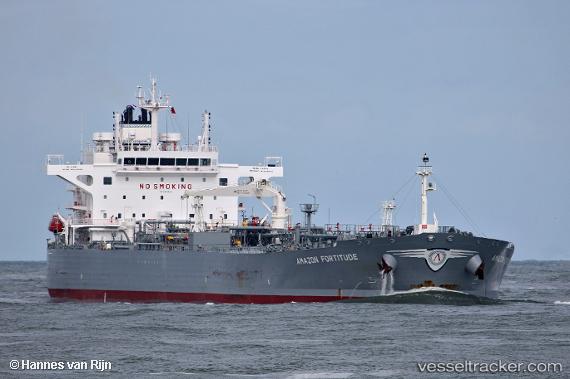
 AMAZON FORTITUDE
Current Status
Where is the vessel?
AMAZON FORTITUDE is currently in Near Pulau Ayer Chawan, based on AIS data received less than 1h ago.
Latest AIS update:
Current position: 1.26049° N, 103.72617° E (Near Pulau Ayer Chawan)
Average speed (last 7 days): Loading…
Average speed (last 30 days): Loading…
Vessel profile: AMAZON FORTITUDE is a Crude Oil Tanker with dimensions 228m x 40m.
This page combines live AIS, route history, probable destination signals, nearby traffic, and port activity for practical vessel monitoring.
The current position of vessel AMAZON FORTITUDE is 1.26049 lat / 103.72617 lng. Updated: 2026-04-24 04:12:04 UTCNearest reference points:
- Near BUKOM ISLAND
- Near PASIR PANJANG Terminal
- Near JURONG ISLAND
Currently sailing under the flag of Greece ![]()
AMAZON FORTITUDE built in 2018 year
Deadweight:
72837 tDetails:
Live Vessel AMAZON FORTITUDE Analytics (details, animations, etc.)
Recent AIS points (UTC):
2026-04-24 01:42:04 UTC · 1.26047, 103.72618 · SOG 0 kn · COG 66°2026-04-24 02:09:04 UTC · 1.26047, 103.72620 · SOG 0.1 kn · COG 66°
2026-04-24 04:09:04 UTC · 1.26048, 103.72618 · SOG 0 kn · COG 66°
2026-04-24 04:12:04 UTC · 1.26049, 103.72617 · SOG 0 kn · COG 66°