 vesseltracker.com
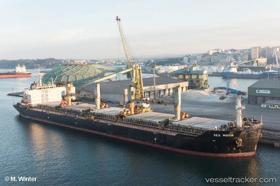
 SEA MOON
Current Status
Where is the vessel?
SEA MOON is currently in 42 nm NW of Pazar, based on AIS data received about 1h ago.
Latest AIS update:
Current position: 41.77498° N, 40.42876° E (42 nm NW of Pazar)
Average speed (last 7 days): Loading…
Average speed (last 30 days): Loading…
Vessel profile: SEA MOON is a Bulk Carrier with dimensions m x m.
This page combines live AIS, route history, probable destination signals, nearby traffic, and port activity for practical vessel monitoring.
The current position of vessel SEA MOON is 41.77498 lat / 40.42876 lng. Updated: 2026-04-29 23:48:18 UTCNearest reference points:
- 31 nm N of Pazar
- Near Rize
- Near Hopa
Currently sailing under the flag of Greece ![]()
Details:
Live Vessel SEA MOON Analytics (details, animations, etc.)
Recent AIS points (UTC):
2026-04-29 18:58:38 UTC · 41.79456, 40.61772 · SOG 10.1 kn · COG 268°2026-04-29 18:58:38 UTC · 41.79456, 40.61772 · SOG 10.1 kn · COG 268°
2026-04-29 18:58:38 UTC · 41.79456, 40.61772 · SOG 10.1 kn · COG 268°
2026-04-29 23:48:18 UTC · 41.77498, 40.42876 · SOG 0.4 kn · COG 219°