 vesseltracker.com
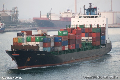
 TANGER A
Current Status
Where is the vessel?
TANGER A is currently in 22 nm S of Fuengirola, based on AIS data received less than 1h ago.
Latest AIS update:
Current position: 36.17448° N, 4.71185° W (22 nm S of Fuengirola)
Average speed (last 7 days): Loading…
Average speed (last 30 days): Loading…
Vessel profile: TANGER A is a Container Ship with dimensions m x m.
This page combines live AIS, route history, probable destination signals, nearby traffic, and port activity for practical vessel monitoring.
The current position of vessel TANGER A is 36.17448 lat / -4.71185 lng. Updated: 2026-04-27 22:57:33 UTCNearest reference points:
- 30 nm E of Ceuta
- Near Fuengirola
- Near Nueva Andalucia
Currently sailing under the flag of Morocco ![]()
Details:
Live Vessel TANGER A Analytics (details, animations, etc.)
Recent AIS points (UTC):
2026-04-27 19:22:24 UTC · 36.13412, -4.66788 · SOG 3.8 kn · COG 332°2026-04-27 19:57:33 UTC · 36.16101, -4.70694 · SOG 2.1 kn · COG 206°
2026-04-27 22:09:43 UTC · 36.18094, -4.70403 · SOG 1.2 kn · COG 125°
2026-04-27 22:57:33 UTC · 36.17448, -4.71185 · SOG 0.7 kn · COG 167°